

![]()
How High is the Mississippi?
A Guide to water levels of the Upper Mississippi and its tributaries
Map: Click on a red or green link for the US Geological Survey's hydrological information.
The 2020 Spring Flood Outlook released by the National Weather Service, Quad Cities.
See the the La Crosse area Weather Service flood prediction.
USGS WaterWatch - updated daily
North Central River Forecast Center (with daily updates)
River observations and forecasts
Facebook: NOAA NWS North Central River Forecast Center
Hydrologic Data in Graphs and Text
Mississippi
levels at cities from St. Cloud, Minn., to Muscatine, Iowa.
(one page, lots of scrolling, but use drop-down menu to choose locations.)
Water
levels of the Upper Mississippi and its tributaries
Click on a red
or green link on the map for the
US Geological
Survey's hydrological
information.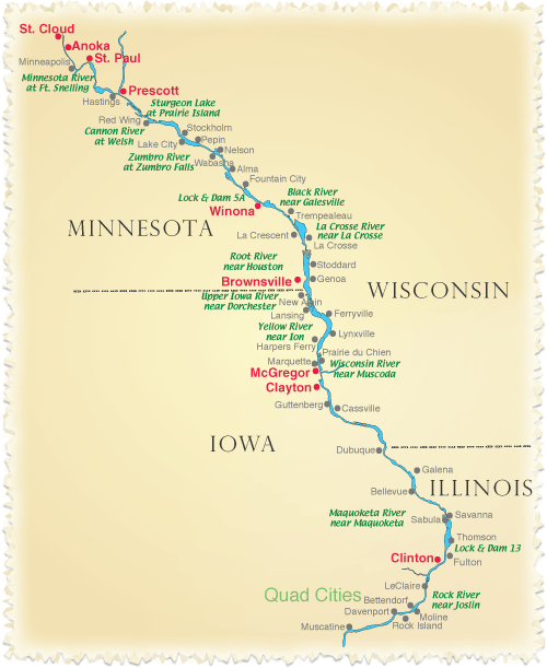
Click on a red or green link for the US Geological Survey's hydrological information.
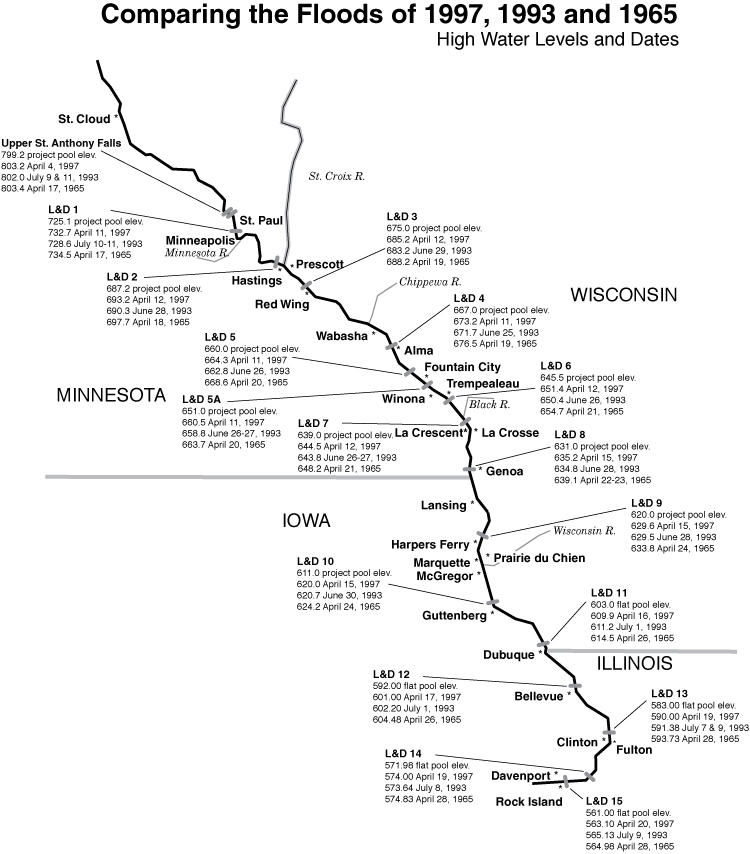
See Big River's chart comparing high water of 1965, 1993 and 1997
PDF JPEG
Wondering about the weather on the Upper Miss? Check out our weather map