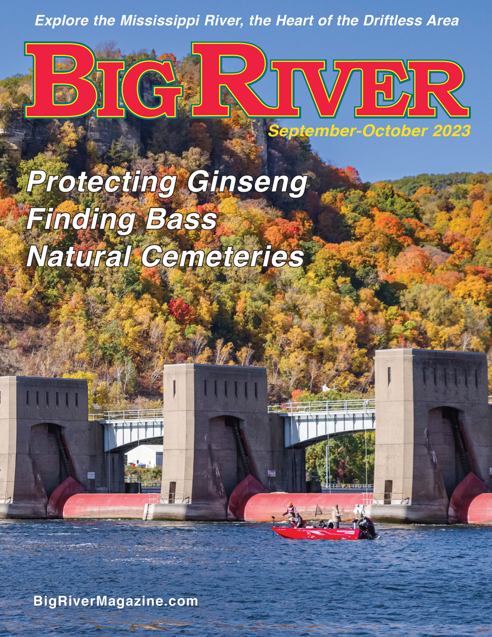
|

Frequently Asked Questions
Mississippi River facts:
• The river is between 2,320 miles and 2,350 miles long, depending on how it’s measured.
• It begins at Lake Itasca in Minnesota — called the Headwaters — where it is so shallow you can step across it on well-placed stones, and ends at the Gulf of Mexico.
• The Mississippi River watershed drains 41 percent of the continental United States and 15 percent of all North America.
• The river’s name comes from an Anishnabe (Ojibwe) word, “misi-ziibi,” which means “great river.”
• The Mississippi borders 10 states.
• About 40 percent of all the ducks and waterfowl that nest in North America use the Mississippi River as a flyway.
• The Mississippi provides a home for 241 species of fish.
Does it always flow north to south?
The first stretch of the Mississippi, in northern Minnesota, flows north out of Lake Itasca, then describes a big question mark above the Twin Cities.
It flows to the northeast in the Twin Cities from Fort Snelling to downtown St. Paul and also downriver of Red Wing, Minn.
It flows east southeast then south in a series of three steps from Red Wing to Trempealeau, Wis.
It flows nearly straight west between Davenport and Muscatine, Iowa.
It flows northeast for about 12 miles upriver of Grafton, Ill.
In the 180 mile stretch from Cape Girardeau, Mo., to the Missouri-Alabama border, it flows in every direction, in big ox-bow loops.
How many locks and dams are there?
There are 29 locks and dams on the Upper Mississippi. The first one, the Upper St. Anthony Lock and Dam, is in Minneapolis. The last one, Lock 27, is at river mile 185.5, near Granite City, Illinois. There are two locks upstream of Lock and Dam 1, at St. Anthony Falls. There is no Lock and Dam 23, but there is a Lock and Dam 5 and a 5a.
What are river miles?
One of the river’s biggest tributaries is the Ohio River, which joins the Mississippi at Cairo, Ill. For navigation on the Upper Mississippi, this point is referred to as River Mile 0. Points upstream of River Mile 0 are measured in river miles upstream from 0, following the middle of the river’s navigation channel, or Main Channel. For instance, Clinton, Iowa, is at River Mile 521, downtown St. Paul is at River Mile 839 and Lake Itasca is at River Mile 1,345.5.
What is an Upper Mississippi pool?
The locks and dams divide the river into pools named for the downstream lock and dam. So Pool 10 refers to the stretch of river between Lock and Dam 10, at Guttenberg, Iowa, to Lock and Dam 9, upstsream, near Lynxville, Wis.
What is a double lockage?
Barges are about 195 feet long and 35 feet wide, while most of the locks on the Upper Mississippi River are 600 feet long and 110 feet wide. So a towboat pushing six barges (three barges wide by two barges long) just about fills up a lock.
When a towboat pushes more than six barges, the crew has to break the tow in two and each part locks through separately. Then on the other side of the lock the two sections are rejoined. This usually takes from 90 minutes to two hours. A 15-barge tow is usually the largest you will see on the Upper Mississippi. When it gets to a lock, the towboat pushes the first nine barges into the lock chamber and the cables connecting first nine barges to the rest of the tow are removed. The tow backs up a little, the lock gates are closed and the water level in the lock is raised if the tow is headed upstream or lowered if it’s headed downstream. Then the barges are pulled out of the lock and the towboat and remaining barges lock through. The two sections are cabled together again and the tow continues on its journey.
What are wing dams and closing dams?
Wing dams and closing dams were built to direct more of the river’s flow into the navigation channel, or Main Channel, to discourage the buildup of sediment there. Wing dams extend at right angles from the shore and are usually just under the water’s surface. Closing dams stretch across backwater channels branching off the Main Channel and are also usually just below the water’s surface.
Both wing dams and closing dams are mostly made of rock, so they can capsize boats and pose a danger to boat hulls and propellers. The end of large wing dams is often marked with a channel buoy. You may be able to see eddies above wingdams and closing dams, depending on their depth and the speed of the current.
What do you mean by Asian carp?
The term “Asian carp” or “invasive carp” usually refers to four carp species from Asia — silver, big head, grass and black carp — which escaped from commercial operations in the southern U.S. into the natural environment over the last few decades, where they have caused a great deal of damage and displaced native species. Silver carp are the species that jumps high out of the water, sometimes landing in boats or smacking boaters.
The term “Asian carp” is meant to exclude common carp, which were deliberately introduced into North America well over a century ago. They also originated in Asia and have been transplanted to many parts of the world for food and sport. They are the most popular freshwater fish in the world. However they cause a lot of environmental damage in the Upper Midwest.
What is a floodplain forest?
A floodplain forest is a forest near a river or stream that often floods, usually in the spring. On the Upper Mississippi, common floodplain trees include silver maples, cottonwoods, willows and swamp white oaks. The understory often includes poison ivy and cardinal flowers. Invasive aliens Reed canary grass and buckthorn have been overwhelming native plants in many floodplain forests.
Download complete issues from 2006 and 2007 (pdfs)
Back
Issues
Read Stories Published
in past issues of Big River
Coldwater Cave - May- June 2016
By Capt. Ted Peck
2015 Mississippi River Paddlers(pdf)
By John Sullivan
The Big Campus: Augsburg's River Semester (pdf) - Nov-Dec 2015
The river was their classroom for three months. By Ryan Johnson
Nighthawk Twilight - July-Aug 2015
Carp Poetry Winners - July-Aug 2015
12 Great Rivertown Gardens (pdf) - May-June 2015
Where's the Carp? Commercial fishermen have noticed an overall decline in the number of common carp - May-June 2015
Sex Life of Floodplain Trees - March-April 2015
Essay, "Only the
River is Real" by Vincent Kavaloski
March-April 2014
Mapping the River (pdf) by
Ryan Johnson
March-April 2014
Emma Big Bear
(pdf)
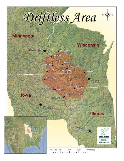
Repairing Driftless Area Fields and
Streams (pdf) The Driftless
Area — spanning the river in southwest Wisconsin, northwest Illinois,
northeast Iowa and southeast Minnesota — contains hundreds of miles of
trout streams fed by clear, 50-degree groundwater and springs emanating
from the limestone-dominated bedrock. Countless cold-water streams
meander through Driftless Area valleys.
Sand Dollars
— Mining Frac Sand in the River Valley (pdf)
July-August 2011
Summer of
Weeds
Nov-Dec 2010
The
Almost-Built Canal: Linking Lake Superior to the Mississippi
(pdf)
March-April 2010
Flood Run also
PDF
March-April 2010
The Day WWII Came to Lake Pepin
November-December 2007
Iceboating on the Mississippi
January-February 2007
Look
down on the river
Overlooks, lookouts, precipices and blufftop peaks
An
Otter Kind of Critter
River
Book Reviews
Bridges
over the Mississippi
Hand-Carved
Decoys (pdf)
More
Stories from Big River Magazine
|